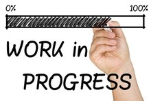
 Next week I'll be heading to Florida for a very different kind of workshop. At least a very different type of workshop for me. I'll be going to the International Forum for Space Weather Assessment. We'll still be talking science, but instead of talking about our latest research we'll be looking at our field and trying to determine how we're doing.
The planning for this workshop started late last year, but it now seems to have an increased awareness surrounding it. With the President's proposed budget massively cutting research spending, and an apparent public distrust of science research, it seems like a great opportunity for scientists to take some time for self reflection. How are we doing as a field? Are we making progress towards a better understanding of the world around us? Where could we improve the pipeline from research understanding to operations and technology, ultimately to benefiting society? We do ask these questions fairly regularly, both as an individual and as a community. When we write papers we have to put our research and the new results in context of previous work and understanding. When writing proposals we must state how this proposed research builds off of previous understandings and might bring light to a question which has yet to be cracked. When refereeing those papers or grant proposals, we must rank the author/proposer's assessment of where their work stands. We ask these questions when we propose conference sessions, and after conference sessions at diner with colleagues or later in the evening over drinks at the bar. However, those conversations don't often make it down into writing. Granted, we're also not perhaps looking at the whole pipeline; from research to its impact on society. Once a year the Living With a Star (LWS) steering committee determines, with the help of the community, what areas are ripe for research and suggests grant calls with a specific bent on research that will ultimately benefit society. A couple times a decade we do take a slightly different, but a bit more far afield look at the entire field. These decadal and semi-decadal surveys try to summarize what big steps were made in the last 5 - 10 years and propose what are the most pressing research areas we as a field should pursue in the coming 5 - 10 years. The research in the decadal survey may not be called out to directly benefit society, but it all does progress our understanding of the world we live in. As it often takes more than 10 years to go from proposing a satellite mission to the launch and then many more years for the data to be analyzed, 10 years isn't necessarily a long term view. It may also take decades before we can determine what new theories and ideas are more correct than others. For instance, it was almost 20 years between the time when CRRES examined the radiation belts and Van Allen Probes were launched to revisit this location. As there are currently no new radiation belt mission planed, it may be another 20+ years before we can return again. Science is a slow process. Science may be a slow process, but we can still see how we're advancing which is really kind of cool! We see it in our ability to provide better space weather forecasts with more accurate models. We see it in the evolution of our theories. We see it in the new discoveries we find when we send new sensitive instruments into space. But a lot of that is qualitative. Can we show our progress more quantitatively? We think so, and that is one of our major goals for the workshop in Florida. This is all still a work in progress, so if you have comments/suggestions/would like to join the group, please let us know! Below I've outlined a few of the different approaches we're hoping to take. If you want to follow along with our progress check out our working group website. Application Readiness Levels: The first way we have proposed to track our progress is with Application Readiness Levels (ARL). ARLs are very similar to technology readiness levels (TRL) which are used for instrumentation, but instead are applied to a specific application. These were originally developed by the Earth Science Division at NASA (this is one of the divisions which would receive massive cuts from the budget, but that's a whole other post). We hope to use them for Space Physics and Space Weather applications. For instance, one of the applications we hope to track is our ability to predict satellite drag. Although we think of the atmosphere at the altitude of a satellite as almost non-existent, it still is significant. In fact, with changes in solar intensity and geomagnetic activity the density changes enough to increase the amount of drag on a satellite which leads to the satellite loosing altitude and ultimately de-orbiting unless it is moved back up. Probably the most famous satellites to have this done are the Hubble telescope and the international space station. We have models that try to account for and predict the amount of satellite drag one would experience. With the ARL we can track how well the modeling currently does as well as identify where we may need to improve our understanding, gather more data for inputs to the models, and ultimately refine our forecasts. Tracking Usage of Data: Citations are perhaps the standardized testing of science and may not always be the best way to determine an increase in understanding, but it is something that is nice and quantitative. The results from looking at how often a data set is used in published work probably shouldn't be taken alone, but it does often show a trend. The question that we hope this type of examination will answer is how many people use the data from a specific mission. Do only people who were on the mission team use the data, or does the community (both US and international) see it as value added to their studies? The more people who use this data set may imply the usefulness of continuing to collect that type of data. Tracking Usage of Models/Forecasting/anomaly analysis: The data for this is perhaps going to be a bit harder to find. However, it would be incredibly useful to be able to track who our end users are, where they get the data/forecasts/research from, and how they use it. Some of this gets into a bit of a sticking point. For example, if a sudden event upset occurs on a spacecraft, it's hard to confirm that that indeed was the problem. We also need the help of end users for this as they are the ones who see when space weather affects them, and how well our forecasts are able to predict and inform them. They can also tell us if what we think is important information for them is indeed useful. We, the scientist, may think that it's important to predict whether a solar storm is going to produce a geomagnetic storm, but the end user may only care to know if the CME is going to hit the magnetosphere when their equipment is up during the day. Of course there are many other ways we can try to track our field's progress. Over the coming months as our group meets and starts to gather and analyze the data, I'll try to update you all on what we find. And if you have any suggestions, comments, ideas, let us know! republished and modified with permission from AlexaHalford.weebly.com
0 Comments
First Full Mapping of Near-Earth Plasma Transport Achieved, Thanks to the Van Allen Probes3/27/2017 This post is written by Solene and it deals with her recent work. We hope you'll enjoy the ride!  Maps are developed to best describe what surrounds us. That is true on the ground, and it is also true in space. There, the most interesting maps are maps of traffic conditions, i.e., maps that tell us how fast transport is, and in what the direction the flow is, depending on location. The only slight difference is that in space we are dealing with plasma transport, ions and electrons, rather than flows of cars and trucks.
To detail traffic in space, we must know both the magnetic field and the electric field: how strong are they? In what direction are they pointing? But unlike the magnetic field, the electric field is very difficult to measure, especially close to Earth! To circumvent this challenge, scientists have made assumptions and used theoretical considerations, rather than observations, to draw a simple picture of what they think the electric field should be around Earth. This simple picture implies that the traffic conditions are as if the cold plasma was riding a giant merry-go-round, with the Earth in the center. In other words, the cold plasma is thought to rotate at the same speed as the Earth’s rotational speed, i.e., to be in corotation with the planet. Yet, this has not been proven experimentally. In fact, some sporadic particle measurements have already indicated that the merry-go-round picture was not quite right. Using data from the Van Allen Probe satellites, we managed to make the first ever comprehensive observations of plasma transport due to the electric field close to Earth. This is a technical feat that allows us to test our 50 year old theories, at last! And the results are exciting! Based on an analysis of more than 2 years of data, we confirmed that the cold plasma was not simply riding along a merry-go-round. In particular, we found that the speed and direction at which the plasma was drifting depended on the time of the day (or, in other words, that they depended on the location with respect to the Sun). We also found that, on average, the rotational speed of the cold plasma was 5 to 10% slower than that of the Earth. We must now understand why! In short, our observations offer new context to existing theories; theories that merit reviews in our ongoing quest to better understand near Earth space! For more information on that topic, you can:
Solene Our predictions of solar storms have not been very accurate until now – here's whyMiho Janvier, University of DundeeWhen a space hurricane was unleashed from the sun on January 7 2014, space-weather centres around the world sent out warnings. The hurricane was heading directly for Earth and was predicted to produce a strong geomagnetic storm. But then an unexpected thing happened: the storm bypassed Earth and headed for Mars instead. It confirmed that our techniques for predicting such events are not as accurate as we would like. I am one of the co-authors of a new paper that provides an insight into why the predictions were wrong and what we can do about this in future. Space storms are a regular part of our sun’s activity. These so-called coronal mass ejections are a by-product of dramatic events called solar flares. They happen in active regions of the sun where a great amount of energy is built up in the form of a tangled magnetic field. This acts like a rubber band that has been twisted too far, snapping as it releases its stored energy. The geomagnetic storms that occur when these ejections hit Earth can have dramatic consequences. Beautiful auroras in the night sky might be sights to behold, but equally GPS and telecommunication systems that rely on satellites can be disrupted, while radio black-outs can make it necessary to re-route air travel. In the worst scenarios, there can be strong surges of electrical currents that cannot be supported by national electric grids. This can lead to major power outages, such as the one experienced by Montreal and the Quebec region in Canada in March 1989. Our findingsThe progress of the January 2014 solar flare in the sun’s atmosphere was monitored by the Solar Dynamics Observatory, a NASA mission launched in 2010 dedicated to our hosting star. Our research team, which was lead by Dr Christian Möstl from the Austrian Academy of Sciences, analysed the regions surrounding the storm’s original location on the sun. We found that the area surrounding it on one side was another intensely active region with a strong magnetic field, while the other side was occupied by a weak magnetic field called a “coronal hole”. The team concluded that the former strong field pushed the erupting storm away, channelling it into the weak field path and away from its original route. The flare behind the storm
Once the storm was on its way out into space, it was then recorded by several space probes, including the Advanced Composition Explorer in Earth’s orbit and the Curiosity Rover on Mars. In particular, the Martian robot reported a decrease in the cosmic rays in its vicinity, the so-called Forbush effect. This phenomenon takes place when the magnetic field of the solar cloud deflects the energetic particles, originating from outer space, which constantly bombard a planet. This data helped our team to build a model to reproduce the evolution of the solar cloud in space, and hence its arrival times, both at Earth and at the red planet. This should improve the models that scientists use for making real-time forecasts of space weather, such as those used by the UK MET Office space weather prediction centre, which opened in October 2014. In short, we reached two conclusions. For accurate forecasts, we will have to monitor the surroundings of the point of origin of the solar activity in future, since these appear to strongly dictate how coronal mass ejections develop. This will ultimately tell us whether a coronal mass ejection will hit the Earth, at which angle and with what intensity. Second, it is highly important that we continue to improve our models for describing how solar storms evolve once they leave the sun. This is what allows us to predict their arrival times at Earth, enabling national authorities to prepare for their consequences as accurately as possible. To do this, much more research is still required into areas such as the mechanisms underlying the ejection of solar storms, how they evolve in space and how they interact with a planet’s natural magnetic shields. That is a key challenge for my field in the coming months and years. Miho Janvier, Lecturer in Mathematics, University of Dundee This article was originally published on The Conversation. Read the original article. Predicting daily space weather will help keep your GPS on targetBrett Carter, RMIT UniversityIt’s well known that severe space weather events – which are quite rare – can have a negative impact on our use of Global Positioning System (GPS) enabled devices. But our research, published in Geophysical Research Letters, shows that another form of space weather – which occurs on a daily basis – can cause problems for GPS too. Knowing how to predict – or forecast – these daily space weather events is the key to protecting those people and industries who rely on GPS. The awareness and use of the GPS has dramatically increased over the past few decades, no doubt in part due to the availability and affordability of in-car satellite navigation systems and GPS-capable smart phones. But the use of GPS in industries in Australia, including agriculture, mining and construction, has also dramatically increased and is expected to boost the nation’s economy by up to A$13.7-billion by 2020. This increased use and reliance on GPS in particular has actually increased our society’s vulnerability to space weather. As detailed in other online articles, space weather influences our use of many space-based technologies and assets around the world. Disturbances in the ionosphereA common, but much less reported, aspect of space weather is a plasma disturbance that occurs in the Earth’s ionosphere during the night-time hours, called equatorial plasma bubbles. As the name suggests, these disturbances take place in the vicinity of the magnetic equator, such as South East Asia and Northern Australia. In some longitude sectors, such as across Africa, these plasma bubbles occur almost every night all year round. 
The process responsible for the onset of these ionospheric disturbances does not involve energetic explosions on the sun’s surface, like the commonly known solar flares and coronal mass ejections. Instead, plasma bubbles are internally driven disturbances in the ionosphere that happen on a day-by-day basis. After sunset, low electron density plasma from the lower ionosphere rises up into the high electron density plasma in the upper ionosphere, similar to a light fluid rising into a heavy fluid. This process is known as the Generalised Rayleigh-Taylor instability. The steep gradients at the edges of the bubble generates plasma waves, or turbulence. A break in the signalThis turbulence scatters radio waves that travel through it, such as the radio signals used in satellite communications, and in the positioning, timing and navigation of GPS. The result on the ground is that the received signal begins to randomly fluctuate in amplitude and phase (an effect called ionospheric scintillation) and becomes unrecognisable by the receiver. This regularly causes the satellite-to-ground radio link to become completely severed. When using GPS, this only really becomes a problem when the receiver loses several satellites simultaneously, which is common at locations close to the magnetic equator because of these plasma bubbles. But in the cases where only one satellite is being used, such as satellite communications, losing lock on the primary satellite has obvious negative implications. 
A recent study investigated the potential impact of plasma bubbles in an event when radio communications failures occurred during a fatal engagement between US combat soldiers and Taliban fighters in Afghanistan. Due to the broad radio frequency range affected by these plasma disturbances, affected applications also include other forms of satellite signals and communications; for example, satellite cellular communications and television broadcasting. Forecasting the bubblesCurrently, there does not exist a non-experimental and openly available model or online product that informs people of potential GPS disruptions due to plasma bubbles. This is largely because there is still a lot that we do not understand about these disturbances. Scientifically, the seasonal behaviour of plasma bubbles is relatively well understood, but why they happen on one day and not the next is still a significant and ongoing challenge in ionospheric physics. As such, a key research goal within this particular field is to develop a reliable day-to-day space weather forecasting capability specifically for plasma bubbles, in a similar manner to the traditional “rainy day” forecasts given by meteorologists. Our study used an artificial neural network (ANN) prediction algorithm, which is a self-learning program that is trained using a given dataset of several parameters. In this case, those parameters were several solar wind quantities measured by the Advanced Composition Explorer spacecraft, which is located at the Lagrangian point L1 between the sun and the Earth. The algorithm used this data to predict the level of geomagnetic activity resulting from the solar wind measured. Outputs from this prediction algorithm were combined with physics-based upper atmospheric modelling to attempt to predict the onset of these disturbances. We were able to show up to 95% accuracy in plasma bubble prediction, potentially giving anyone affected by ionospheric scintillation a number of hours notice of potential disruptions. With such forecasts, people and industries relying on GPS will be able to plan and account for these disruptions before they occur. Some geomagnetic activity is useful for GPSOur results also showed that common and low-intensity geomagnetic storms, which are associated with plasma disturbances from the sun’s surface, can effectively stop the equatorial plasma bubbles from ever growing and causing disruptions on GPS. This is important because during the peak bubble seasons (from February to April and from August to October in the Australasian region), the conditions are ripe for plasma bubble growth everyday. We showed that geomagnetic storms change the global upper atmospheric wind system in a way that prevents the bubbles from growing at the equator during these periods, and this was well supported by our GPS observations. These geomagnetic disturbances from the sun stop the bubbles from growing, and therefore provide opportunities for people to continue to use GPS at night-time during these peak plasma bubble seasons. So, for those who use GPS at low-latitude locations – including in South-East Asia, the Pacific, South America and Africa – a geomagnetic disruption from the sun will actually help to stop GPS scintillation events after sunset at times of the year when scintillation events normally occur every night. Brett Carter, Postdoctoral Researcher in Space Weather and Ionospheric Physics, RMIT University This article was originally published on The Conversation. Read the original article. Why the Earth's magnetic poles could be about to swap places – and how it would affect usPhil Livermore, University of Leeds and Jon Mound, University of LeedsThe Earth’s magnetic field surrounds our planet like an invisible force field – protecting life from harmful solar radiation by deflecting charged particles away. Far from being constant, this field is continuously changing. Indeed, our planet’s history includes at least several hundred global magnetic reversals, where north and south magnetic poles swap places. So when’s the next one happening and how will it affect life on Earth? During a reversal the magnetic field won’t be zero, but will assume a weaker and more complex form. It may fall to 10% of the present-day strength and have magnetic poles at the equator or even the simultaneous existence of multiple “north” and “south” magnetic poles. Geomagnetic reversals occur a few times every million years on average. However, the interval between reversals is very irregular and can range up to tens of millions of years. There can also be temporary and incomplete reversals, known as events and excursions, in which the magnetic poles move away from the geographic poles – perhaps even crossing the equator – before returning back to their original locations. The last full reversal, the Brunhes-Matuyama, occurred around 780,000 years ago. A temporary reversal, the Laschamp event, occurred around 41,000 years ago. It lasted less than 1,000 years with the actual change of polarity lasting around 250 years. Power cut or mass extinction?The alteration in the magnetic field during a reversal will weaken its shielding effect, allowing heightened levels of radiation on and above the Earth’s surface. Were this to happen today, the increase in charged particles reaching the Earth would result in increased risks for satellites, aviation, and ground-based electrical infrastructure. Geomagnetic storms, driven by the interaction of anomalously large eruptions of solar energy with our magnetic field, give us a foretaste of what we can expect with a weakened magnetic shield. In 2003, the so-called Halloween storm caused local electricity-grid blackouts in Sweden, required the rerouting of flights to avoid communication blackout and radiation risk, and disrupted satellites and communication systems. But this storm was minor in comparison with other storms of the recent past, such as the 1859 Carrington event, which caused aurorae as far south as the Caribbean. 
The impact of a major storm on today’s electronic infrastructure is not fully known. Of course any time spent without electricity, heating, air conditioning, GPS or internet would have a major impact; widespread blackouts could result in economic disruptionmeasuring in tens of billions of dollars a day. In terms of life on Earth and the direct impact of a reversal on our species we cannot definitively predict what will happen as modern humans did not exist at the time of the last full reversal. Several studies have tried to link past reversals with mass extinctions – suggesting some reversals and episodes of extended volcanism could be driven by a common cause. However, there is no evidence of any impending cataclysmic volcanism and so we would only likely have to contend with the electromagnetic impact if the field does reverse relatively soon. We do know that many animal species have some form of magnetoreception that enables them to sense the Earth’s magnetic field. They may use this to assist in long-distance navigation during migration. But it is unclear what impact a reversal might have on such species. What is clear is that early humans did manage to live through the Laschamp event and life itself has survived the hundreds of full reversals evidenced in the geologic record. Can we predict geomagnetic reversals?The simple fact that we are “overdue” for a full reversal and the fact that the Earth’s field is currently decreasing at a rate of 5% per century, has led to suggestions that the field may reverse within the next 2,000 years. But pinning down an exact date – at least for now – will be difficult. 
The Earth’s magnetic field is generated within the liquid core of our planet, by the slow churning of molten iron. Like the atmosphere and oceans, the way in which it moves is governed by the laws of physics. We should therefore be able to predict the “weather of the core” by tracking this movement, just like we can predict real weather by looking at the atmosphere and ocean. A reversal can then be likened to a particular type of storm in the core, where the dynamics – and magnetic field – go haywire (at least for a short while), before settling down again. The difficulties of predicting the weather beyond a few days are widely known, despite us living within and directly observing the atmosphere. Yet predicting the Earth’s core is a far more difficult prospect, principally because it is buried beneath 3,000km of rock such that our observations are scant and indirect. However, we are not completely blind: we know the major composition of the material inside the core and that it is liquid. A global network of ground-based observatories and orbiting satellites also measure how the magnetic field is changing, which gives us insight into how the liquid core is moving. The recent discovery of a jet-stream within the core highlights our evolving ingenuity and increasing ability to measure and infer the dynamics of the core. Coupled with numerical simulations and laboratory experiments to study the fluid dynamics of the planet’s interior, our understanding is developing at a rapid rate. The prospect of being able to forecast the Earth’s core is perhaps not too far out of reach. Phil Livermore, Associate Professor of geophysics, University of Leeds and Jon Mound, Associate Professor of Geophysics, University of Leeds This article was originally published on The Conversation. Read the original article. |
AuthorA bunch of us Space Nerds Archives
July 2017
Categories
All
|
 RSS Feed
